Logo


GeoSIGFOIFPentaxKompassVeroLaserTamayapizzi

Software >Carlson SurvCE


Powerful Data Collection with Carlson SurvCE


Carlson SurvCE is the first choice in data collection software, combining advanced functionality, ease-of-use, and sheer capability:

Carlson SurvCE is a complete data collection system for Real Time (RTK) GPS and Total Stations with in-field coordinate geometry. It supports the widest range of popular and new release RTK GPS and conventional/ robotic total stations.

Existing users, please visit the Carlson SurvCE resource center: SurvCE.com

SurvCE 4.0 has been released and is now ready for download. Constantly being upgraded, SurvCE 4.0 gives users the option to import text in drawings in addition to blocks;allows GPS base records from the raw file to be processed into the CRD file; and offers a new 2D sketch polyline and snap option. Version 4.0 of Carlson Software’s SurvCE data collection software now includes a Live Digital Level (LDL) or electronic bubble vial feature. Learn how to configure SurvCE 4.0 for the LDL.

SurvCE4.0 is now available

The Carlson SurvCE 4.0 upgrade was released on June 15, 2014. For those moving from any SurvCE 2.0 versions to 4.0, the cost is $300. The price for 4.0 for those upgrading from an initial purchase of SurvCE 3.0 over this past year is $150. Literally 100s of enhancements have been built into SurvCE 4.0, which continues to be upgraded throughout the year.

Here’s one of the newest aspects of Carlson SurvCE—SurvCE can read the GIS feature/attribute structure from a client’s Esri GIS geodatabase, collect additional survey-grade data to that schema, and write it back as ArcGIS compatible data in a single seamless workflow. No office software required! See it in action in this webinar, along with an introductory discussion by Brent Jones of Esri about the new opportunities for surveyors in the GIS marketplace.

 
  • SurvCE 4.0 is available in more than two dozen languages. These include: English, Spanish, French, French (Canadian), Portuguese, Czech, Dutch, simplified Chinese, Korean, Greek, Italian, Polish, Hungarian, Swedish, Latvian and more.

    Top new SurvCE 4.0 features include:

    • Supports full output reporting in GNSS analysis
    • GPS base records from the raw file may be processed into the CRD File
    • Has full compatibility with the Stewart Weir Software
    • Enhanced performance on new capacitive screen data collectors
    • Description edit boxes now allow easy access to feature code list
    • Field-to-Finish supports creating circles
    • Point project automatically creates a customizable output file containing station, offset, and elevation and other user-defined fields
    • Supports LandXML Road Model
    • Allows GIS storing in any stakeout routine
    • Supports text import from drawings
    • RW5 file now reads and writes faster
    • Supports freehand sketching in the map screen
    • Brazil SIRGAS 2000 UTM Zone 18S is now supported
    • Supports scalable pixels in background images
    • Calculate Area/ Sliding uses a new faster and more robust method

    Top features from 3.0 release:

    • Ability to stake roads by complete LandXML Road Model—a new method augmenting “By Sections,” “By Templates,” and “From Map”
    • Ability to use point “blocks” from drawings as point symbols or as objects to snap to for stakeout or for creating alignments, with GIS attributes associated with blocks recognized;
    • Messaging and file transfer office to field or peer-to-peer in field;
    • New techniques for best fit smooth curves and tangent curves using Field-to-Finish;
    • Use of RTCM 3.1 messages from virtual reference stations to auto-compute grid and geoid shifts.

    Easy to use

    • Tab-Based MENU Structure. All commands are visible in each menu, preventing the need for Up-Down Arrow Keying to view options.

    Enhanced graphics

    • Collect points in the graphics mode. Points plot as they are shot in the field or entered. There is no need to switch between screens to view your points.

    Read in LandXML

    • Supports LandXML points, DTM, graphics, alignments, profiles and sections.

    Select Features

    New Look

    • SurvCE has a colorful look. Icons have been standardized to create continuity throughout the product, while modernizing the user experience.

    Hot List

    • The Hot List lets users jump to the SurvCE routines that previously had shortcuts without having to memorize key strokes. It also provides shortcut functionality to devices without keyboards.

    Volumes

    • SurvCE can compute volumes between two surfaces, one surface and an elevation or simple stockpile volumes. Surfaces can be defined by graphical entities and points or by Carlson TIN files.

    Help

    • The software has optional on-board help files. These files are the entire user manual and can be installed separately. Click on the SurvCE icon and select Help to get the help document that pertains to the current routine.

    Leveling

    • SurvCE can be used to collect trigonometric level loops and digital level loops. Loops can be processed and adjusted on the device and all existing project coordinate points can be updated.

    GPS Networks

    • SurvCE supports several GPS network protocols, such as NTRIP, TCP and UDP.

    Localization

    • The software supports an unlimited number of localization points. All project scale settings and coordinate system options have been centrally located in the localization dialog.

    Angle Sets in Store Points

    • SurvCE allows users to “Configure” how each reading is measured with regard to direct and reverse options (Formerly know as SS/Trav). If direct and reverse readings are taken at the backsight, then any direct and reverse foresight will be considered an angle set and will be reduced accordingly. This eliminates the need to use a separate routine for angle sets.

    Station Equations

    • SurvCE supports station equations.

    Job Settings

    • SurvCE has the option to use a template DXF file for new jobs so that all layers and colors are automatically created per your company standard
    • It has the option to auto-load cutsheets and control files from the previous job for those users that work on one site continuously
    • SurvCE has the ability to turn off the auto-descriptions in stakeout and completely customize how all stakeout routines behave
    • Point Number by Interval –SurvCE can interval the point ID by using the “Add to Next Pt ID” option. To number all points on the odd numbers, start at 1 and use 2 in this field.

    Feature Coding

    • SurvCE can collect parallel lines using the offset horizontal and offset vertical line drawing commands and close a rectangle by three points using the rectangle command. In the settings section of Special Codes, the user can even auto compute and store the additional points at the line vertices that were created by the software.
    • SurvCE allows the user to code in numerous coding styles that may be defined by their office package.

    Instrument Switching

    • SurvCE keeps track of every instrument completely separate. This includes all base stations, rovers and total stations, so that mixing equipment is easy. Simply configure your gear once and forget it. The instrument icon has been enhanced to allow you to switch between your current equipment.

    Skew Angle Staking

    SurvCE supports staking offsets on a skew angle and provides the option to stake offset intersections and bisectors at angle points and the radius or PI point of an arc without leaving the Stake Line/Arc routine.

    SurvCE Has More

  • *NEW Special Codes

    *NEW SurvCE with ESRI.
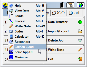
    *NEW Carlson Cloud

    Collect points in the graphics mode

    Tab based menu structure.

    Compute volumes in SurvCE 2.0

    Hot List lets users jump to routines.

    Supports an unlimited number of localization points.

    Job Settings – Customize layers, colors, cutsheets, descriptions and much more.

    Point Number by Interval – Advanced point ID controls.

    Leveling – Collect and process trigonometric & digital level loops.

    Instrument Switching – SurvCE keeps track of every instrument, so switching equipment is fast and easy.

    Feature Coding – Add numerous coding styles & functions.

    Help – Click to get the help document for the current routine.

    Angle Sets in Store Points – Faster, more efficient collection.

  • Recommended system requirements for Carlson SurvCE, Version 4.0X

    Operating System: Windows ® CE 6.0 and higher
    Compatible with Windows Mobile 5.0 and higher
    RAM: 64 MB
    Disk Space: 64 MB (128 MB recommended)
    Processor: 200 Mhz or greater (Strong Arm, X Scale)
    Connections: 9-pin RS232 or Bluetooth
  • Supported Data Collectors

    Carlson SurvCE supports many major manufacturers’ conventional and robotic total stations and RTK GPS systems. These include:
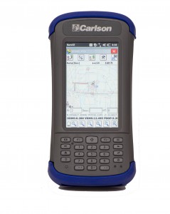
    All new Carlson Surveyor 2 data collector is here

    Carlson Surveyor2

    Carlson MINI2Carlson MINI2

    View Full Screen | Download as PDF | Supported Instrument Default Settings

  • Reviews

    Background information on Carlson survey solutions

    American Surveyor (Jan. 2009) Surveying history in Sudan

    by Rob Rosa, LSIT

    Testimonials

    I cannot say enough about your customer service. Every time I have had an issue or question regarding SurvCE, I have had my questions answered in a complete, timely, and professional manner. I have not found any survey tasks that I cannot perform utilizing SurvCE for construction and topographic surveying and anything that I have a question about your team is quick to answer. Thank you for the great product and the excellent customer service! — Nicholas F. Carter, PE, LSI, F2F Project Manager, Artisan Construction Services, LLC (March 19, 2009)

    Finding my inner Indiana Jones — Using Carlson SurvCE to Survey History. Using [Carlson] SurvCE, I was able to accomplish all necessary tasks, including all the field location work as well as laying out previously located, but now reburied blocks, switching between GPS, conventional total station and robotic total station at a moment’s notice. Topo shots averaged between 1,000, to 1,500 points per day in a six-hour window because of the quickness and intuitiveness of the Carlson software. — Rob Rosa, LSIT, Massachusetts
    Read full story in American Surveyor (January 2009)

  •  

    Product Total Station Support Robotic Total Station Support GPS Support Price
    SurvCE TS $995
    SurvCE GPS Only $1250
    SurvCE RTS $1495
    SurvCE TS-GPS $1995
    SurvCE Complete $2495
    Advanced Roading (Optional) – Requires one of the above product configurations: add $500